Showing posts with label arterial roads. Show all posts

Monday, 5 October 2026

1988: Pymble Interchange opens

Pymble Interchange January 4 1973 SMH 3 map
The original proposal for the Pymble Interchange. Full Citation below.

The Pymble Interchange is the intersection of the Pacific Highway with Mona Vale and Ryde Roads at Pymble. Mona Vale Road and Ryde Road intersect beneath a short road tunnel that carries the Pacific Highway above. It was completed in 1988. 

Prior to 1988, it was a typical intersection, but by the early 1970's it had created traffic problems for North Shore motorists.

Pymble Interchange January 4 1973 SMH 3 enlarged
The intersection of the Pacific Highway, Ryde Road and Mona Vale Road in 1973. Full Citiation below.

In 1973, the NSW Government proposed a three-level interchange. The first level would carry traffic for Mona Vale Road and Ryde Road. The second level would serve as on- and off-ramps for traffic approaching or exiting the Pacific Highway, and the Pacific Highway would be raised to form the third level. Under the scheme, through traffic on the Pacific Highway would be signal-free as they cross the intersection. 

The rail bridge crossing Mona Vale Road, which carries the North Shore Railway line, had to be realigned and shifted eastwards to accommodate the interchange. 

Pymble Interchange January 4 1973 SMH 3

Source: Anonymous. 1973. "Plans for first 3-level interchange in Sydney". The Sydney Morning Herald, January 4: 3. 

The interchange was not completed until 1988. It was opened to traffic on December 21 1988. 

Pymble Flyover December 20 1988 daily mirror 7

Source: Silverman, N. 1988. "$21m present for motorists". The Daily Mirror, December 20: 7. 

The same article also described an earlier scheme in which an overpass would carry through traffic on the Pacific Highway, as in the original 1973 scheme, but traffic signals would be placed to manage traffic entering or exiting the Pacific Highway at the same level as Mona Vale Road and Ryde Road. I've enlarged it for your viewing.

Pymble Flyover December 20 1988 daily mirror 7 enlarged


Monday, 31 March 2025

1979: Syd Enfield Drive opens

Syd Enfield Drive Opens January 10 1979 SMH 1 HD enlarged 2
Full Citation Below.

On January 9, 1979 the Bondi Junction Bypass (renamed as Syd Enfield Drive in 1988) was opened to traffic just two years after approval was given.

Syd Enfield Drive Opens January 10 1979 SMH 1 HD enlarged

Source: Anon. 1979. "By-pass today, mall tomorrow". The Sydney Morning Herald, January 10: 1. 

The 1.3-kilometre road bypasses the Bondi Junction CBD, starting at Oxford Street and Ocean Street in Woollahra and ending at the intersection of Oxford Street, Old South Head Road and Bondi Road, Bondi Junction. 

Syd Enfield Drive Opens January 10 1979 SMH 8 HD  

Source: Anon. 1979. "Taking traffic out of Bondi Junction". The Sydney Morning Herald, January 10: 8. 

With traffic diverted from Oxford Street, it allowed for the closure of Oxford Street between Newland Street and Grosvenor Street to vehicular traffic. It was converted into the pedestrian mall that is seen today. 

All photos were taken by the Author (2025).


In 2025, Oxford Street between Grosvenor Street and Adelaide Street is restricted to buses only. 


Above: Oxford Street between Grosvenor Street and Adelaide Street is a bus-only thoroughfare. Photo taken by the Author (2025).


Monday, 4 September 2023

MILESTONE: Alfords Point Bridge turns 50 (1973) - Opening

Last week, I posted an entry relating to the construction of the Alfords Point Bridge. This week will focus on the opening of the bridge in 1973.

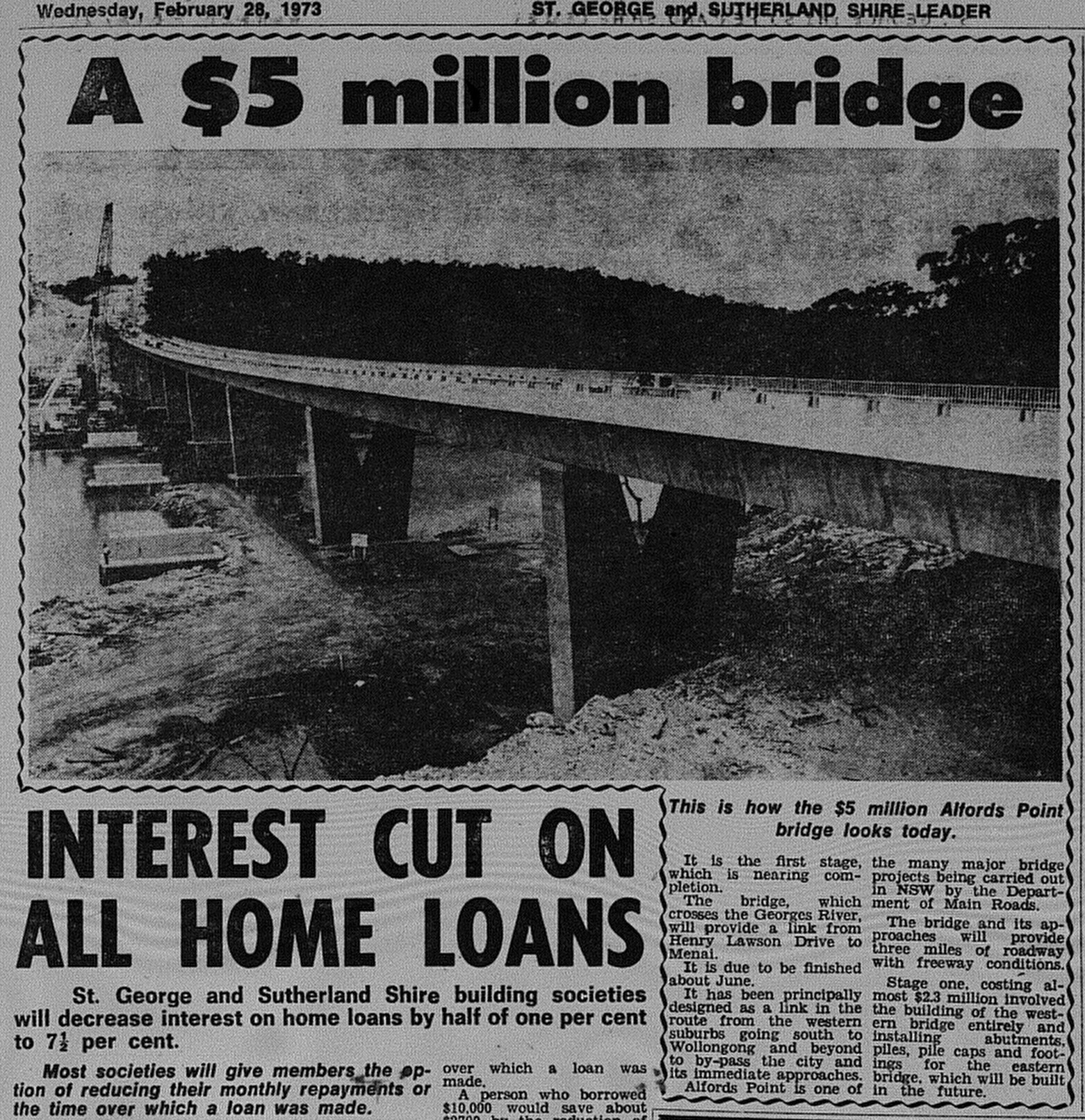
By February 1973, the span of the bridge had been built, and it was anticipated that the bridge would be open to traffic in June of that year. The photo below was taken at the northern approach to the bridge at Padstow Heights, looking south. Note the footings already in place for the future duplication of the bridge in 2008. 

Alfords Point Bridge February 28 1973 The Leader 5 

Source: Anon. 1973. "A $5 million bridge". The St George and Sutherland Shire Leader, February 28: 5. 

It was announced in June that the bridge would open in September. The Lugarno Ferry, which operated downstream linking Lugarno and Illawong, would continue for "some time", before running its last service the following year. 

Alfords Point Bridge August 1 1973 The Leader 11 

Source: Anon. 1973. "New bridge to open soon". The St George and Sutherland Shire Leader, August 1: 11. 

On 7 September 1973, the Alfords Point Bridge was officially opened to traffic by NSW Premier Sir Robert Askin. 2000 people were reported to have attended the opening ceremony, which included an opportunity for the public to walk across the bridge before opening to traffic. The final cost of construction was approximately $5 million. 

Below is coverage from The St George and Sutherland Shire Leader from September 12 1973.

Alfords Point Bridge September 12 1973 The Leader 1

Source: Anon. 1973. "Road snarl ease: Bridge skirts trouble sports". The St George and Sutherland Shire Leader, September 12: 1.

The bridge, when opened, initially carried two lanes of traffic (1 lane each way). This was increased to three lanes with a tidal flow arrangement in place.

Duplication of the bridge occurred in the 2000s. Construction of the new bridge commenced in 2007 and was opened to traffic in 2008. The original bridge reverted to two lanes and carried northbound traffic only, while the new bridge carries two lanes of southbound traffic.

Related Entry

MILESTONE: Alfords Point Bridge turns 50 (1973) - Proposals and construction

Monday, 28 August 2023

MILESTONE: Alfords Point Bridge turns 50 (1973) - Proposals and construction

This year, Alfords Point Bridge turns 50. The three-lane bridge was opened to traffic on 7 September 1973, while the second bridge was opened to traffic as part of its duplication in 2008.

Next week will focus on its opening, but this week, I will share some newspaper features relating to planning and construction. 

The St George and Sutherland Leader in 1961 reported that Menai residents were prepared to fund the construction of a bridge at Lugarno to link the then semi-rural suburb with the rest of Sydney.
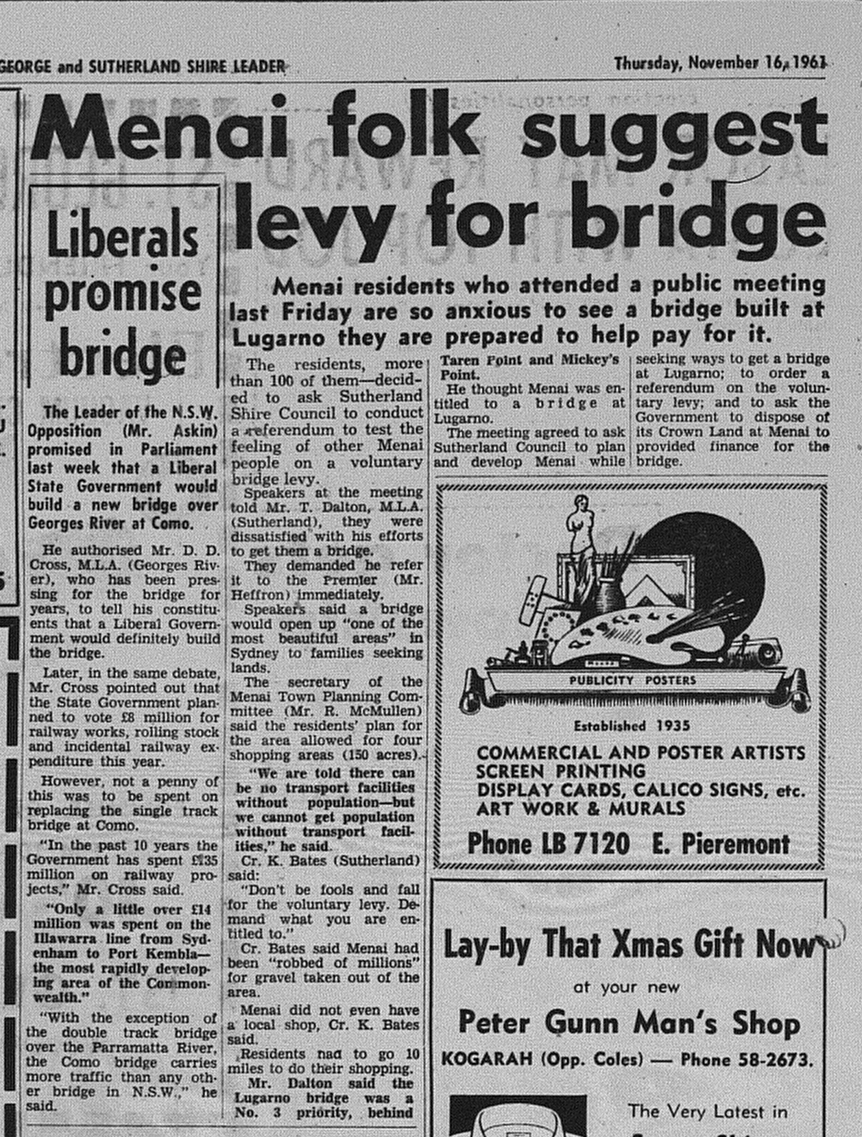
Alfords Point Bridge November 16 1961 The Leader 14

Source: Anon. 1961. "Menai folk suggest levy for bridge". The St George and Sutherland Shire Leader, November 16: 14. 

In 1966, it was reported in The Sydney Morning Herald that the government intended to build a new bridge between Padstow Heights and Alfords Point. The location on the Georges River was selected because it was regarded as located halfway between the Milperra Bridge and Tom Ugly's Bridge. It was intended that contracts would be issued by mid-1968.

Alfords Point Bridge October 7 1966 SMH 6

Source: Anon. "New bridge promised". The Sydney Morning Herald, October 7: 6. 

At the end of 1969, it was announced that tenders would be called to build the new bridge as it was deemed a "high priority" in the Department of Main Roads building program. Apart from providing a third bridge to connect the Sutherland Shire with the St George region, it was to be built as part of a "bypass" or arterial road that would connect Heathcote and Hornsby (known today as the A6).

Alfords Point Bridge announcement 1969

Source: Anon. 1969. "Bridge will connect by-pass". The St George and Sutherland Shire Leader, December 3: 1.  

By February 1970, it was announced that work would start "almost immediately". In November 1970, it was announced that John Holland was the successful tender to build the bridge at an estimated $2.3 million, with a projected completion date of mid-1973. 

Alfords Point Bridge February 25 1970 the leader 1 (2)

Source: Anon. 1970. "Fast north-south: Early Start For Flyover". The St George and Sutherland Shire, February 25: 1. 

Below is an article from The St George and Sutherland Shire Leader reporting on the progress of construction in 1972.

Alfords Point Bridge February 9 1972 The Leader 18

Source: Anon. 1972. "Vital North-South Link Stays on Schedule". The St George and Sutherland Shire Leader, February 9: 18.

A progress report from July 1972 (below) contains a photo on construction of the bridge plus the announcement that John Holland was also to build the bridge connecting the bridge with Davies Street, Padstow.

Alfords Point Bridge July 12 1972 the Leader 15

Source: Anon. 1972. "Second bridge will speed Menai's traffic". The St George and Sutherland Shire Leader, July 12: 15. 

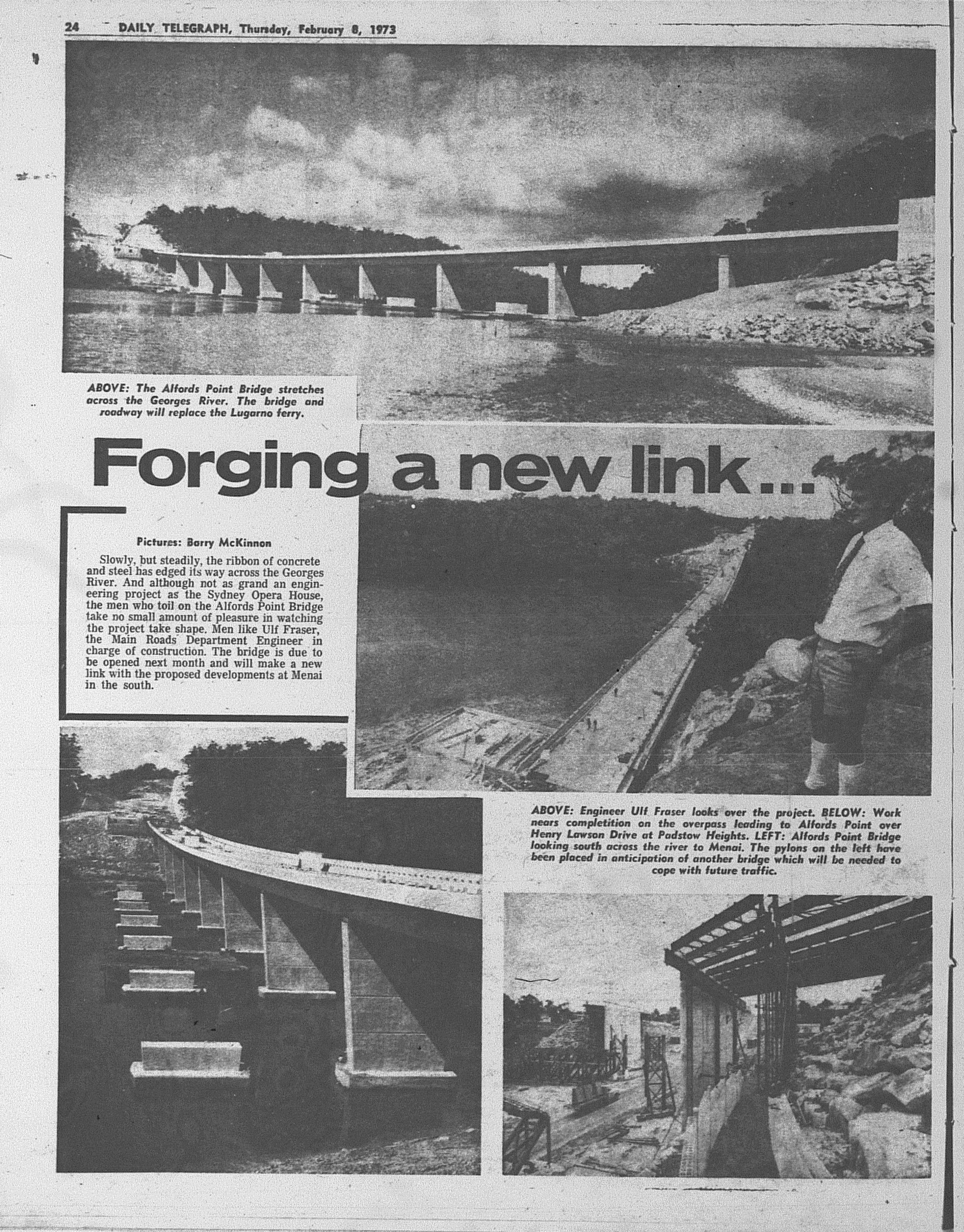
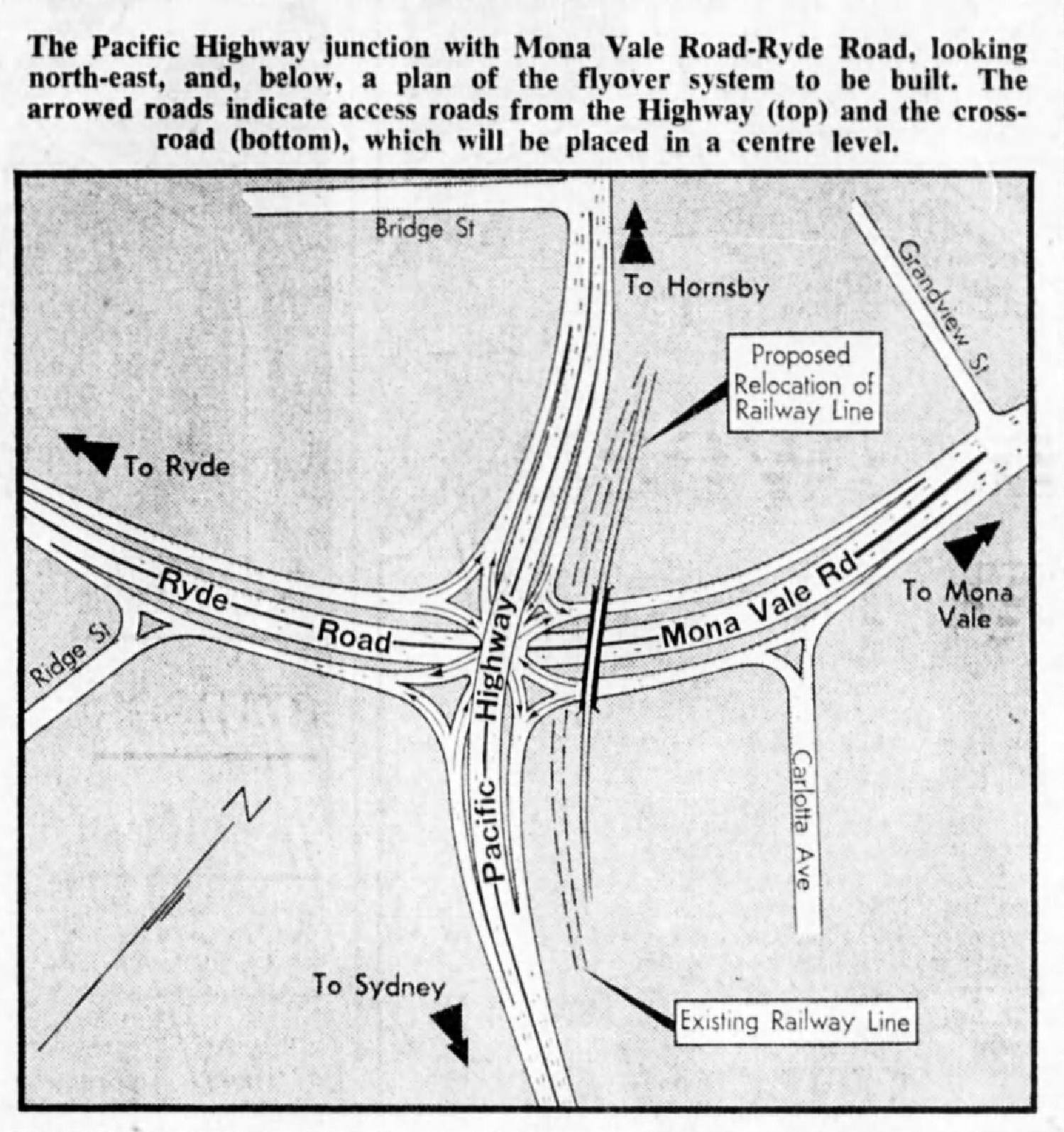
Finally, a photo feature from early 1973 which was published in The Daily Telegraph.

  Alfords Point Bridge February 8 1973 Daily Telegraph 24

Source: Anon. 1973. "Forging a new link...". The Daily Telegraph, February 8: 24.  
Monday, 27 February 2023

1967: De Burgh's Bridge opens

On 15 December 1967, the De Burgh's Bridge which carries Lane Cove Road over the Lane Cove River, was officially opened to traffic. It replaced the bridge of the same name which was opened in 1899. It improved road access between North Ryde and Pymble and also driver safety.

  De Burgh's Bridge opens December 16 1967 daily telegraph 13

Source: Anon. 1967. "End of a bottleneck". The Daily Telegraph, December 15: 13.

Monday, 18 April 2022

1970: One Way tolling introduced on The Sydney Harbour Bridge

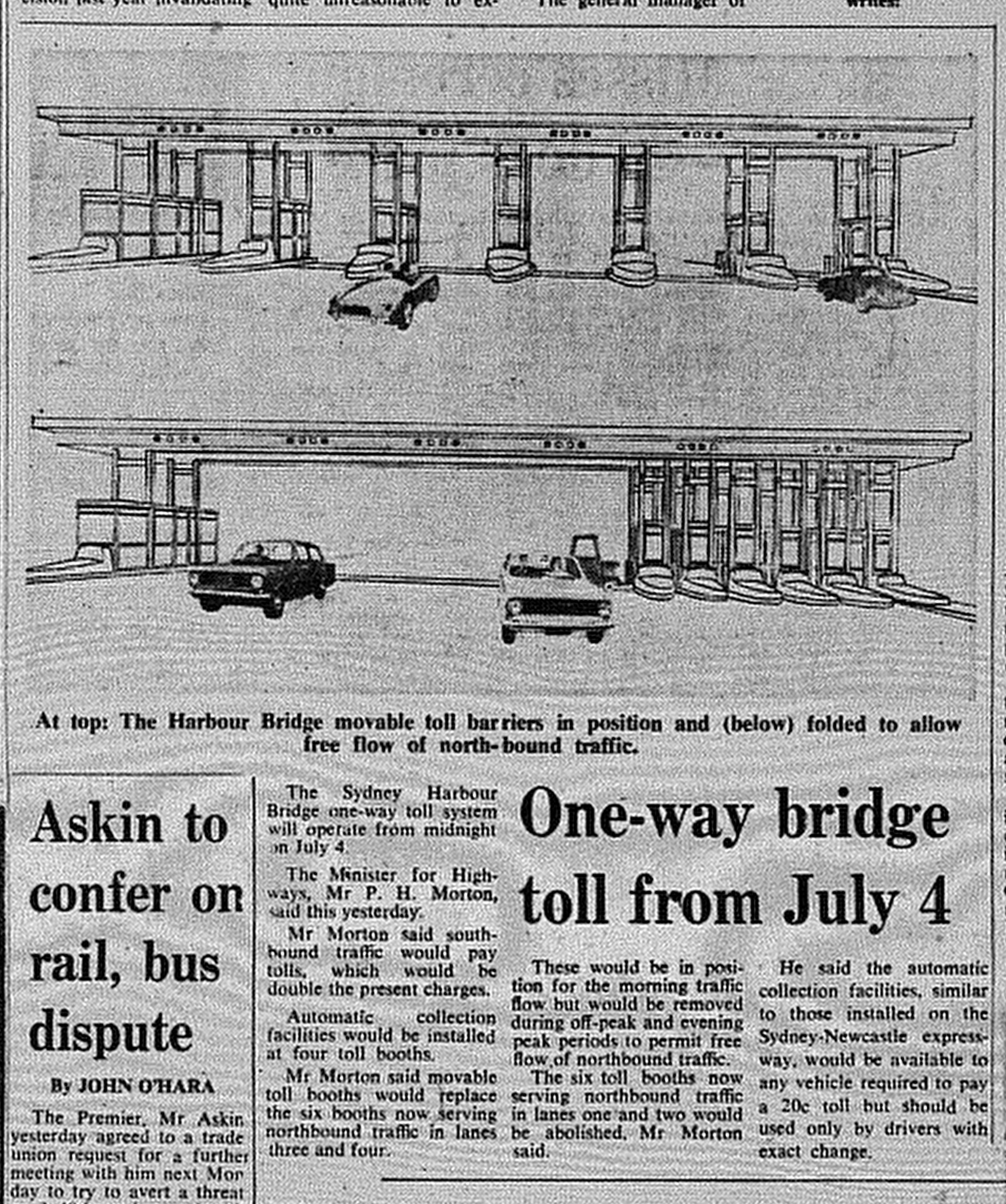
Sydney Harbour Bridge Tollgates June 20 1970 SMH 5


Source:  Anon. 1970. "One-way bridge toll from July 4". The Sydney Morning Herald, June 20: 5. 

From the opening of The Sydney Harbour Bridge in 1932 until 1970, vehicles crossing the bridge had to pay a toll in both directions. By the start of 1970, the toll cost ten cents, equivalent to $1.22 today. Relative to 2022, it was inexpensive, but still attracted complaints from motorists.

One way tolling began on July 4, 1970 with the purpose of improving the flow of northbound traffic especially during peak periods. To compensate for the loss of revenue from north bound traffic, the toll was increased to 20 cents (equivalent to $2.44 today), and would remain at that level until 1987. 

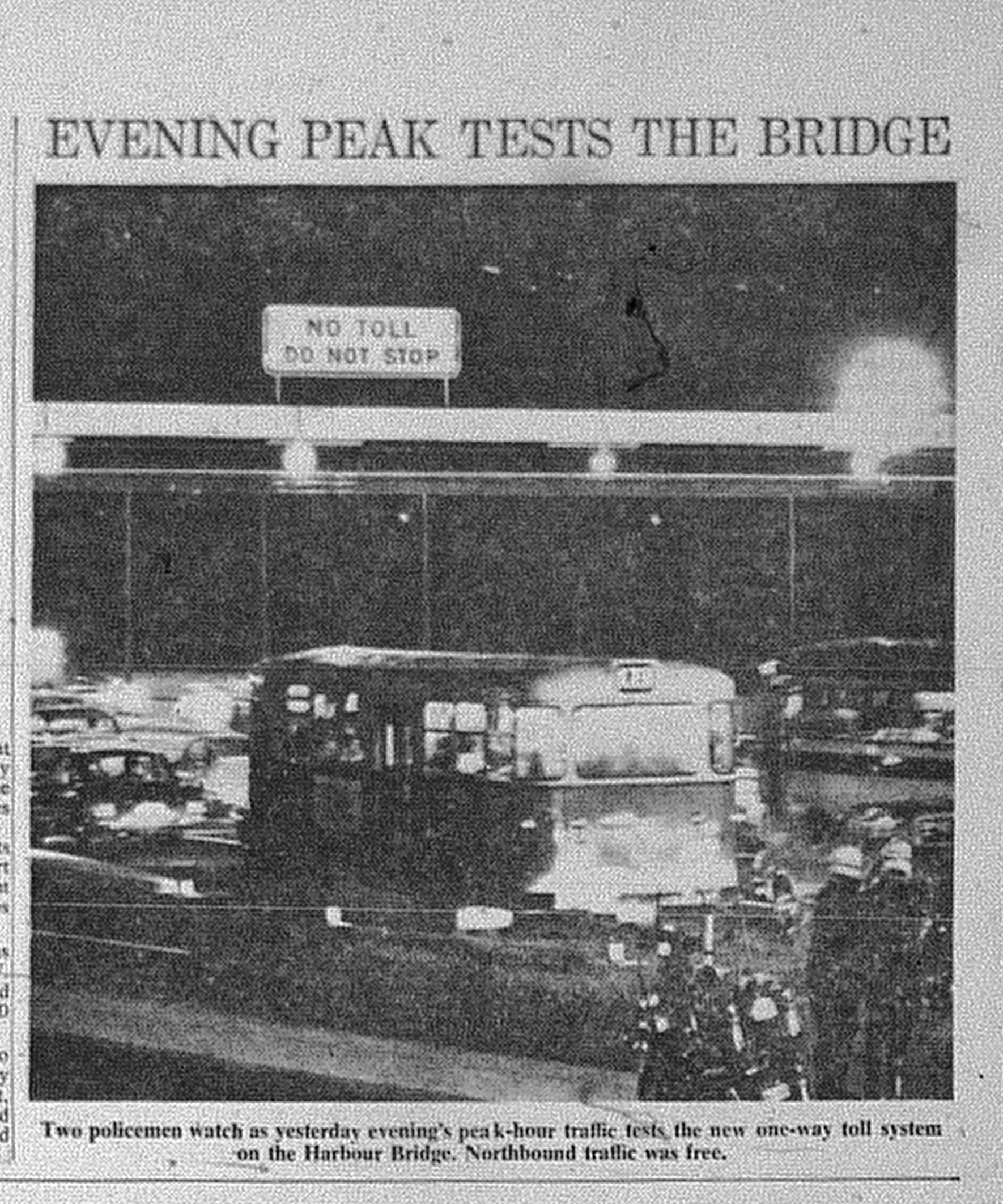
Sydney Harbour Bridge Tollgates July 7 1970 SMH 4
Source: Anon. 1970. "Evening Peak Tests The Bridge". The Sydney Morning Herald, July 7: 4. 

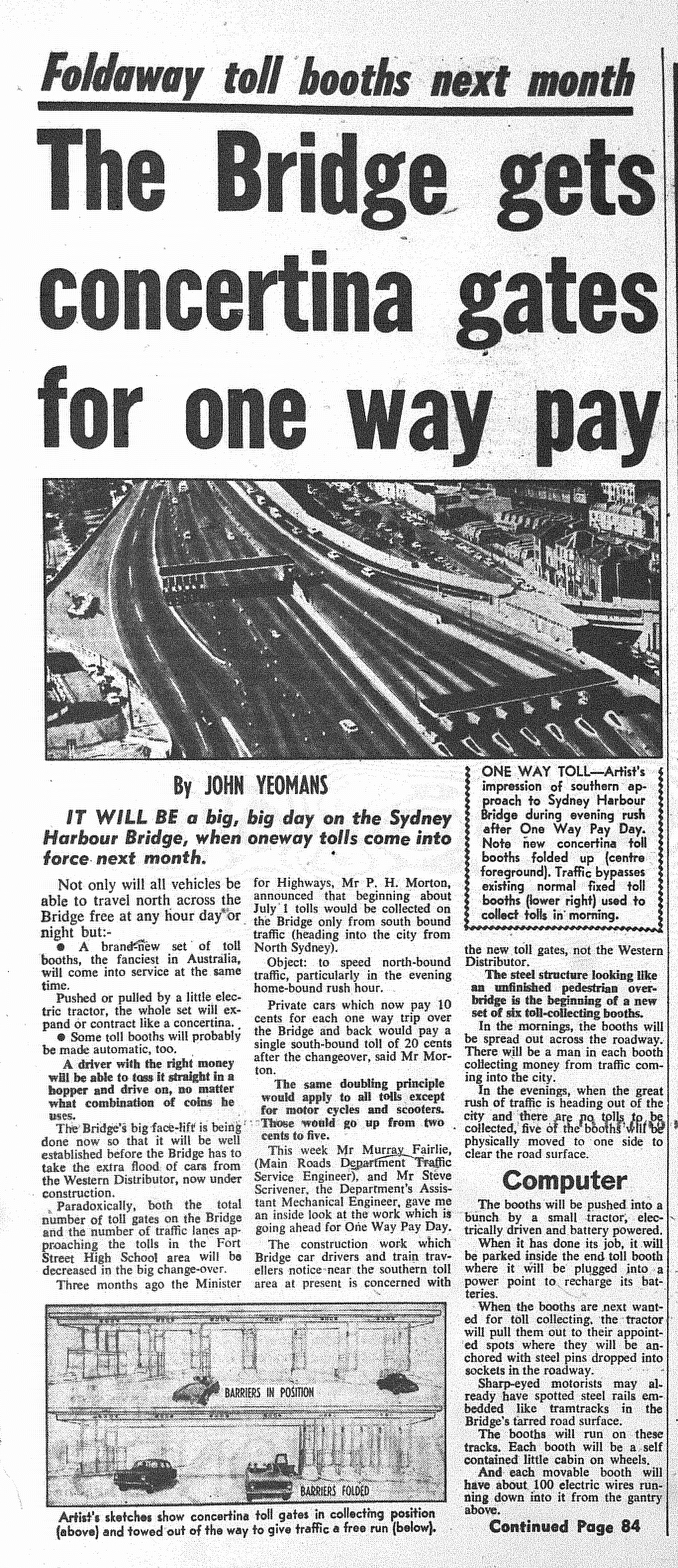
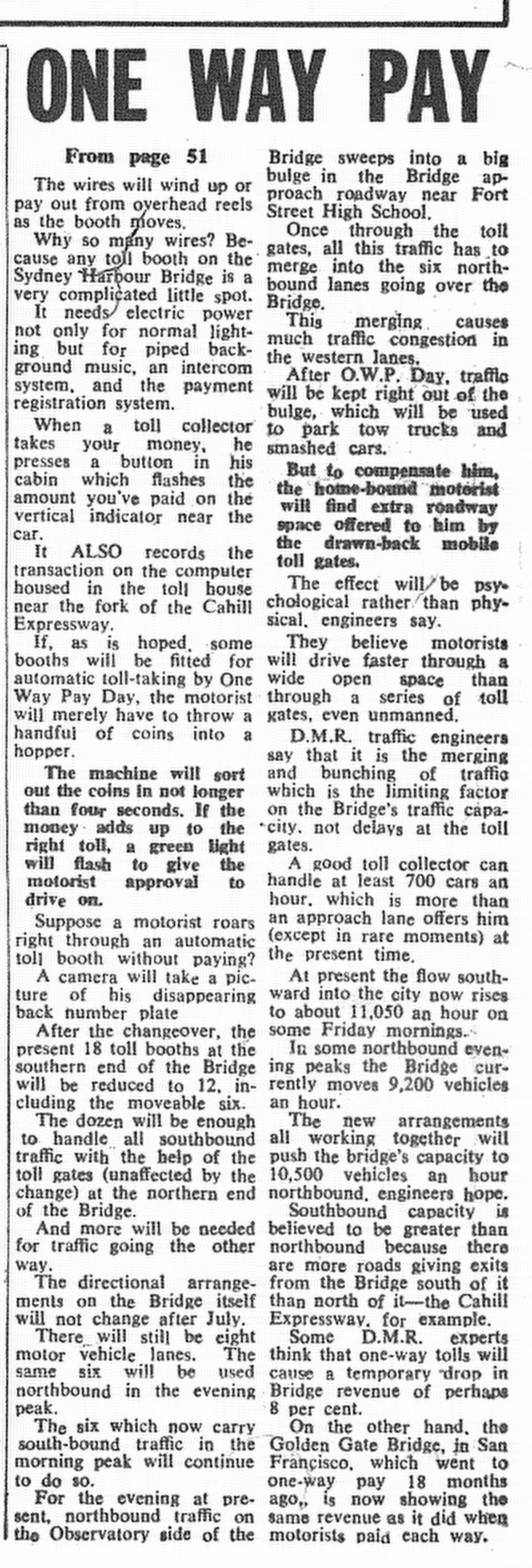
The shift to one way tolling saw the introduction of movable toll barriers that could be folded to allow for the free flow of northbound traffic in the evening, while serving southbound traffic during the morning peak. 

Sydney Harbour Bridge Tollgates June 7 1970 Sun Herald 51

Sydney Harbour Bridge Tollgates June 7 1970 Sun Herald 84
Source: Yeomans, J. 1970. " The Bridge gets concertina gates for one way pay". The Sun Herald, June 7: 51 & 84. 

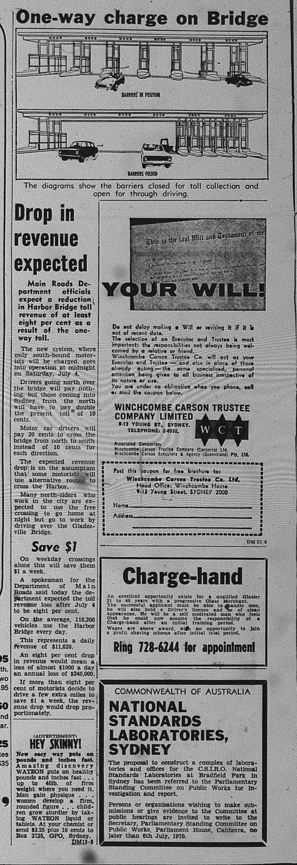
However the doubling of the southbound toll to twenty cents saw a drop in revenue as some drivers sought to save money travelling via the Gladesville Bridge. This was anticipated as reported by The Daily Mirror.

Sydney Harbour Bridge Tolls June 23 1970 daily mirror 24
Source: Anon. 1970. "One-way charge on Bridge". The Daily Mirror, June 23: 24.

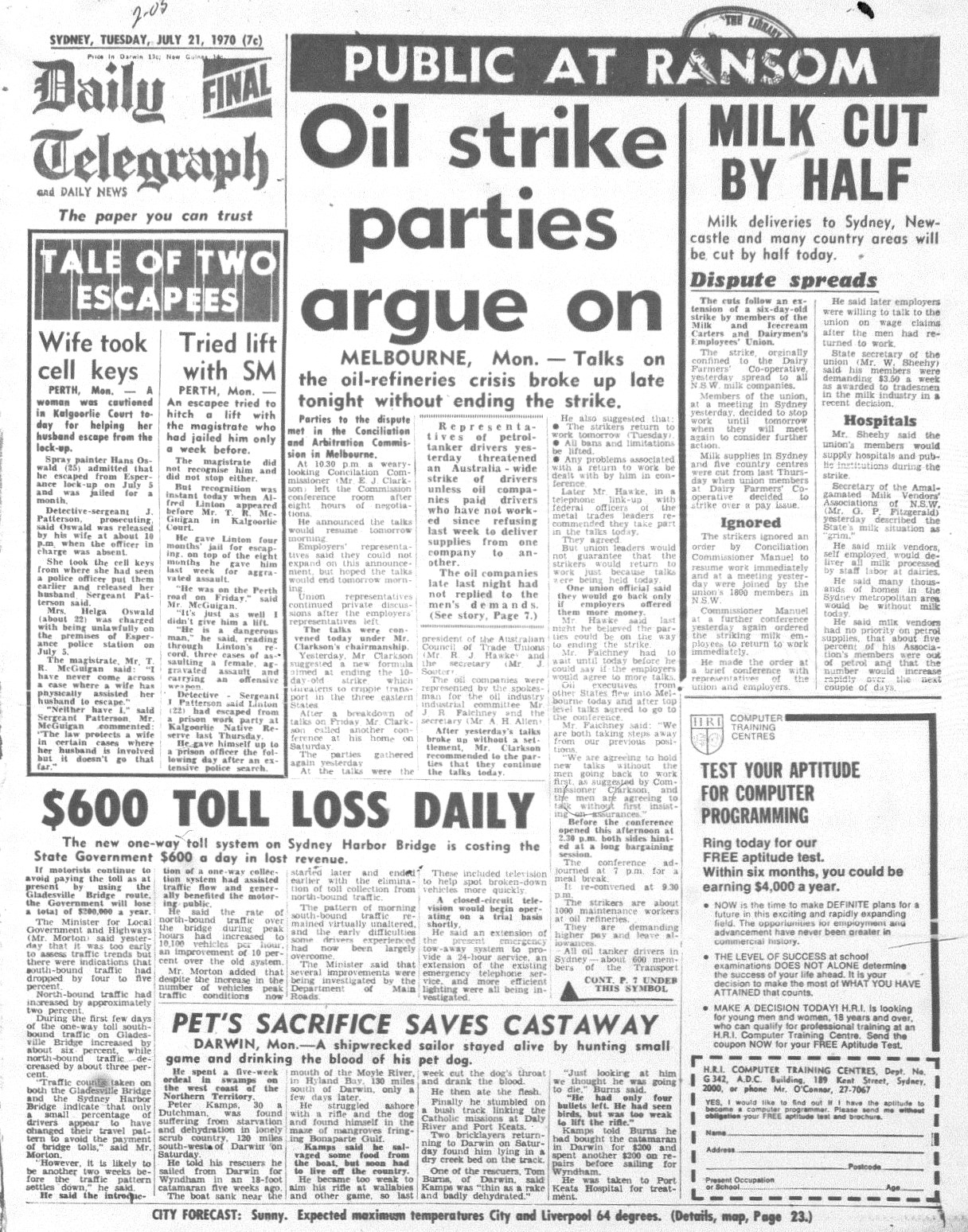
The Daily Telegraph (21 July 1970) reported that revenue from the tolls had decreased by an average of $600 per day, meaning that annual loss of $200 000 in revenue was projected.

Sydney Harbour Bridge Tolls July 21 1970 daily telegraph 1
Source: Anon. 1970. "$600 Toll Loss Daily". The Daily Telegraph, July 21: 1.

The toll booths operated until 2009, when e-tolling was made compulsory for motorists crossing the Sydney Harbour Bridge. However they were not removed until 2016. Below is a video from "Ventia" that was posted on Vimeo.


The RBA Inflation Calculator was used to determine the equivalent value of the tolls in 1970 against that of 2022, adjusting for inflation. 

Monday, 11 October 2021

1964: Sydney's first ring roads

With traffic congestion increasing in Sydney roads during the 1960's, motorists needed to be guided through the metropolitan area to avoid congested urban centres. 

The response by the Main Roads Department was to create a network of ring roads. A ring road in Sydney comprised of main roads that were connected together. Ir meant that drivers could bypass Central Sydney altogether if they needed to. 

In Sydney, ring roads or "Metroads" guided drivers between 1964 and 2013. Ring roads are now alphanumerically numbered e.g. Metroad 3 is now A3. 

Below is an article published in The Daily Telegraph in 1964 which focused on the inroduction of the original ring roads. 

Metroads August 29 1964 daily telegraph 14 

Ring Road 3 (later Metroad 3 and now A3) was the first to be commissioned. The original route largely follows the current A3 with some differences e.g. The original route went through Belfield, Strathfield and Concord as Roberts Road, Centenary Drive and Homebush Bay Drive were yet to either be converted into main roads or yet to be built. 

Two other ring roads were soon commissioned:

Ring Road 1 - Ran along the southern fringe of the Sydney CBD.

Ring Road 5 - Hurstville to Hornsby via Parramatta.

The original ring roads system lasted until 1974, when  they were incorporated into a network of State Roads.