Showing posts with label bridges. Show all posts

Monday, 4 September 2023

MILESTONE: Alfords Point Bridge turns 50 (1973) - Opening

Last week, I posted an entry relating to the construction of the Alfords Point Bridge. This week will focus on the opening of the bridge in 1973.

By February 1973, the span of the bridge had been built, and it was anticipated that the bridge would be open to traffic in June of that year. The photo below was taken at the northern approach to the bridge at Padstow Heights, looking south. Note the footings already in place for the future duplication of the bridge in 2008. 
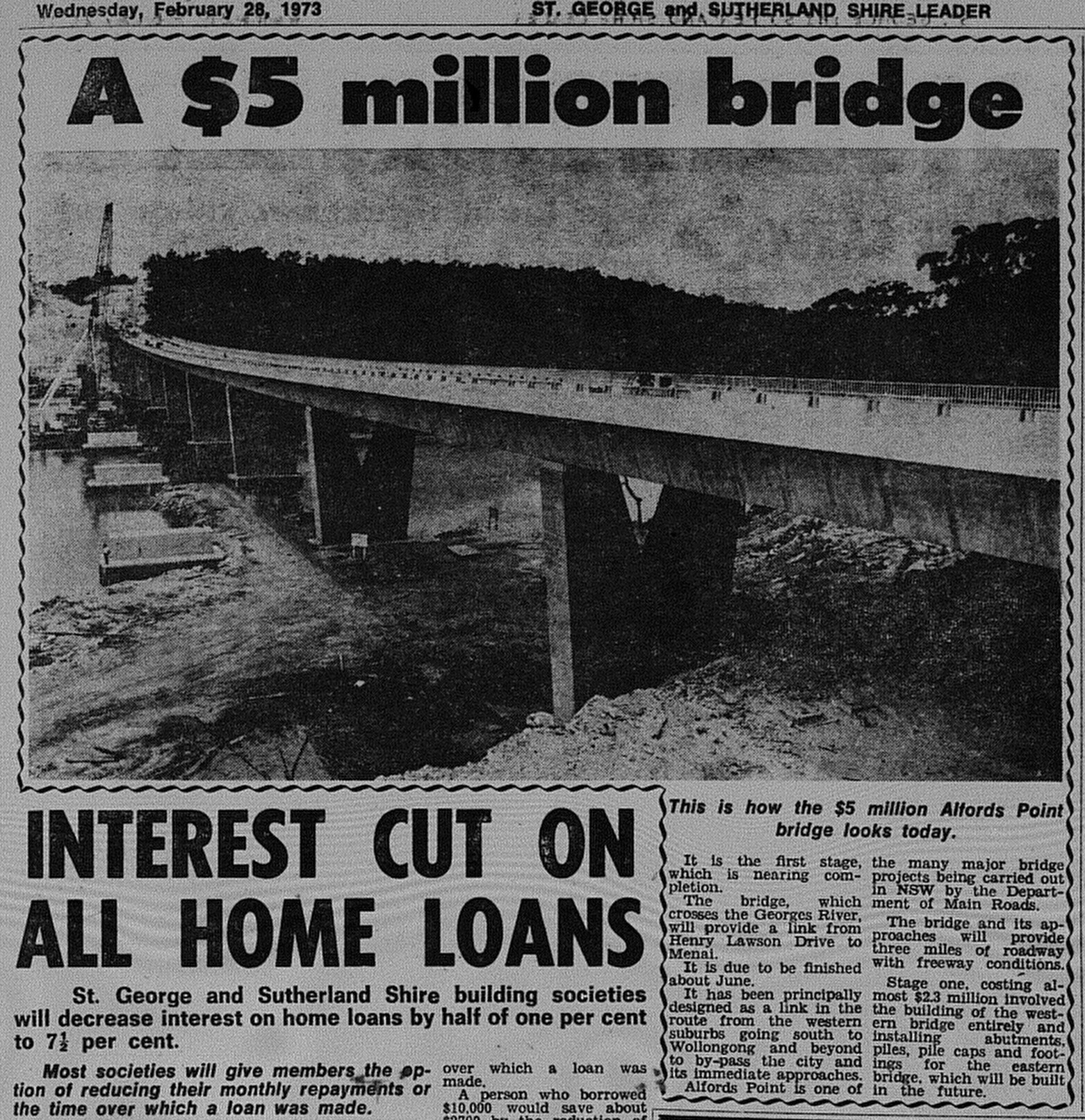
Alfords Point Bridge February 28 1973 The Leader 5 

Source: Anon. 1973. "A $5 million bridge". The St George and Sutherland Shire Leader, February 28: 5. 

It was announced in June that the bridge would open in September. The Lugarno Ferry, which operated downstream linking Lugarno and Illawong, would continue for "some time", before running its last service the following year. 

Alfords Point Bridge August 1 1973 The Leader 11 

Source: Anon. 1973. "New bridge to open soon". The St George and Sutherland Shire Leader, August 1: 11. 

On 7 September 1973, the Alfords Point Bridge was officially opened to traffic by NSW Premier Sir Robert Askin. 2000 people were reported to have attended the opening ceremony, which included an opportunity for the public to walk across the bridge before opening to traffic. The final cost of construction was approximately $5 million. 

Below is coverage from The St George and Sutherland Shire Leader from September 12 1973.

Alfords Point Bridge September 12 1973 The Leader 1

Source: Anon. 1973. "Road snarl ease: Bridge skirts trouble sports". The St George and Sutherland Shire Leader, September 12: 1.

The bridge, when opened, initially carried two lanes of traffic (1 lane each way). This was increased to three lanes with a tidal flow arrangement in place.

Duplication of the bridge occurred in the 2000s. Construction of the new bridge commenced in 2007 and was opened to traffic in 2008. The original bridge reverted to two lanes and carried northbound traffic only, while the new bridge carries two lanes of southbound traffic.

Related Entry

MILESTONE: Alfords Point Bridge turns 50 (1973) - Proposals and construction

Monday, 28 August 2023

MILESTONE: Alfords Point Bridge turns 50 (1973) - Proposals and construction
This year, Alfords Point Bridge turns 50. The three-lane bridge was opened to traffic on 7 September 1973, while the second bridge was opened to traffic as part of its duplication in 2008.

Next week will focus on its opening, but this week, I will share some newspaper features relating to planning and construction. 

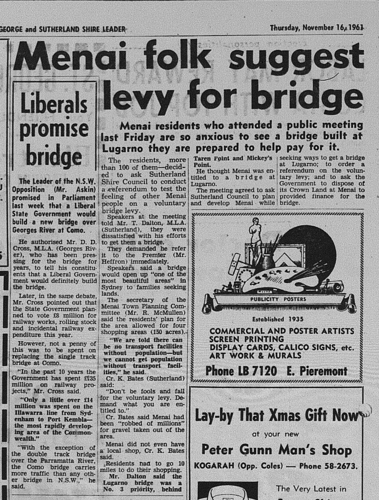
The St George and Sutherland Leader in 1961 reported that Menai residents were prepared to fund the construction of a bridge at Lugarno to link the then semi-rural suburb with the rest of Sydney.

Alfords Point Bridge November 16 1961 The Leader 14

Source: Anon. 1961. "Menai folk suggest levy for bridge". The St George and Sutherland Shire Leader, November 16: 14. 

In 1966, it was reported in The Sydney Morning Herald that the government intended to build a new bridge between Padstow Heights and Alfords Point. The location on the Georges River was selected because it was regarded as located halfway between the Milperra Bridge and Tom Ugly's Bridge. It was intended that contracts would be issued by mid-1968.

Alfords Point Bridge October 7 1966 SMH 6

Source: Anon. "New bridge promised". The Sydney Morning Herald, October 7: 6. 

At the end of 1969, it was announced that tenders would be called to build the new bridge as it was deemed a "high priority" in the Department of Main Roads building program. Apart from providing a third bridge to connect the Sutherland Shire with the St George region, it was to be built as part of a "bypass" or arterial road that would connect Heathcote and Hornsby (known today as the A6).

Alfords Point Bridge announcement 1969

Source: Anon. 1969. "Bridge will connect by-pass". The St George and Sutherland Shire Leader, December 3: 1.  

By February 1970, it was announced that work would start "almost immediately". In November 1970, it was announced that John Holland was the successful tender to build the bridge at an estimated $2.3 million, with a projected completion date of mid-1973. 

Alfords Point Bridge February 25 1970 the leader 1 (2)

Source: Anon. 1970. "Fast north-south: Early Start For Flyover". The St George and Sutherland Shire, February 25: 1. 

Below is an article from The St George and Sutherland Shire Leader reporting on the progress of construction in 1972.

Alfords Point Bridge February 9 1972 The Leader 18

Source: Anon. 1972. "Vital North-South Link Stays on Schedule". The St George and Sutherland Shire Leader, February 9: 18.

A progress report from July 1972 (below) contains a photo on construction of the bridge plus the announcement that John Holland was also to build the bridge connecting the bridge with Davies Street, Padstow.

Alfords Point Bridge July 12 1972 the Leader 15

Source: Anon. 1972. "Second bridge will speed Menai's traffic". The St George and Sutherland Shire Leader, July 12: 15. 

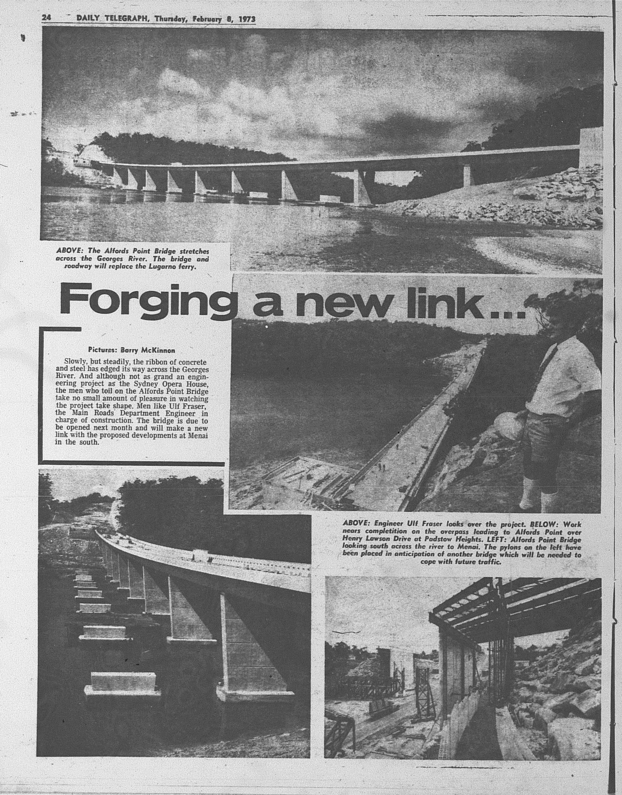
Finally, a photo feature from early 1973 which was published in The Daily Telegraph.

  Alfords Point Bridge February 8 1973 Daily Telegraph 24

Source: Anon. 1973. "Forging a new link...". The Daily Telegraph, February 8: 24.  

Monday, 27 February 2023

1967: De Burgh's Bridge opens

On 15 December 1967, the De Burgh's Bridge which carries Lane Cove Road over the Lane Cove River, was officially opened to traffic. It replaced the bridge of the same name which was opened in 1899. It improved road access between North Ryde and Pymble and also driver safety.

  De Burgh's Bridge opens December 16 1967 daily telegraph 13

Source: Anon. 1967. "End of a bottleneck". The Daily Telegraph, December 15: 13.

Monday, 10 October 2022

1985: Old Como Bridge becomes a footbridge and cycleway

The Old Como Bridge spanned the Georges River between Oatley and Como. It was a single track railway bridge that served the Illawarra and South Coast Railway Lines from 1885 until 1972, when a modern two track bridge was completed next to the original bridge. In 1985, the old bridge was reborn as a footbridge and a cycleway. It was offically opened on 16 December 1985 by Federal MP's Gary Punch (ALP, Barton) and Robert Tickner (ALP, Hughes).

  Como Bridge Walkway December 16 1985 daily telegraph 7

Source. Anon. 1985. "Spokes men bridge river gap". The Daily Telegraph, December 16: 7. 

Monday, 5 September 2022

1971: When Pyrmont Bridge faced demolition

The Pyrmont Bridge has evolved as Sydney has grown and changed. For decades it served as a major arterial connecting western Sydney with the Sydney CBD. The Western Distributor may have made the bridge redundant, but was reborn into a pedestrian walkway with the redevelopment of Darling Harbour.

But half a century ago, Sydney was facing the possiblity of losing it forever, and the lost opportunities that went with it.

In 1971, the first stage of Western Distributor from the Harbour Bridge Tollgates to Day Street was under construction while plans to extend the freeway from Darling Harbour to Glebe were underway. 

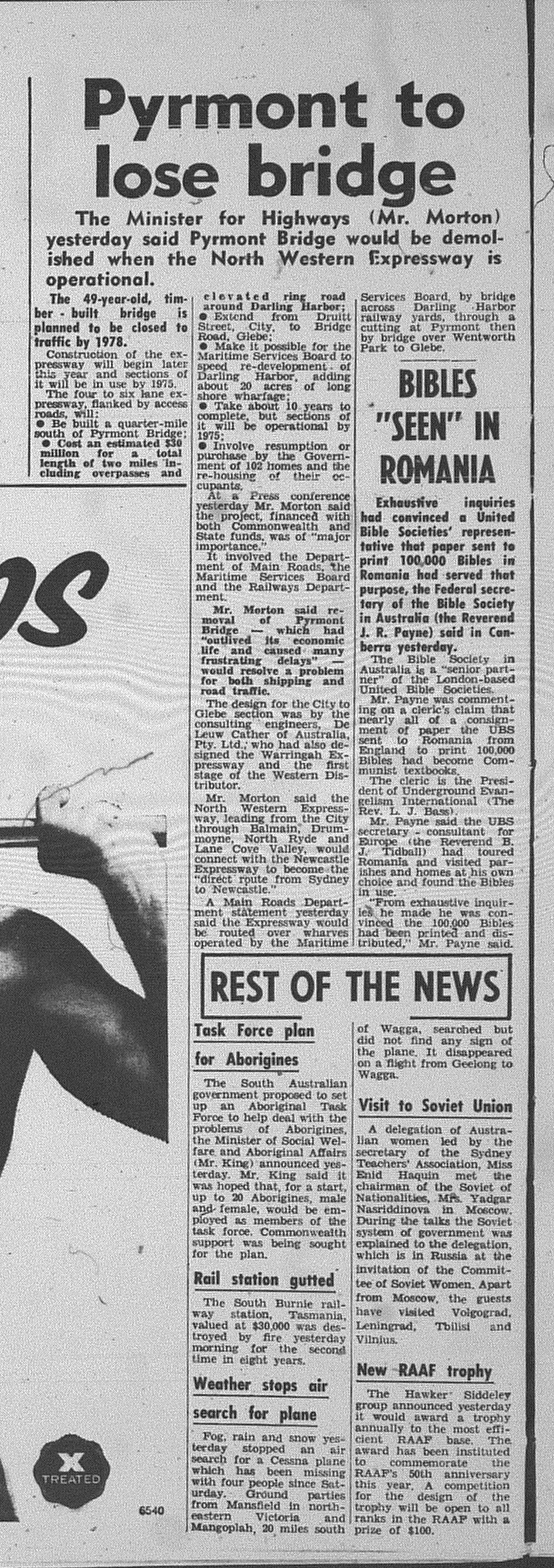
The freeway would render the Pyrmont Bridge redundant and would be demolished, when the expressway was in full operation by 1978.

Pyrmont Bridge June 3 1971 daily telegraph 22

Source: Anon. 1971. "Pyrmont to lose bridge". The Daily Telegraph, June 3: 22. 

In 1980, the westbound viaduct from Day Street to Harris Street was completed. The Pyrmont Bridge was reconfigured to permit eastbound traffic. When the eastbound viaduct from Pyrmont Street to Day Street was opened the following year, the bridge was closed to all traffic.

  Pyrmont Bridge July 24 1981 SMH 9

Source: Name obsecured. 1981. "Pyrmont Bridge closing, but future open to suggestions. The Sydney Morning Herald, July 24: 9. 

With Darling Harbour set to be redeveloped, the bridge was still threatened with demolition. It was reported that the bridge was hindering redevelopment opportunites, while the argument to retain the bridge gained momentum.

Sydneysiders protested against plans to demolish the bridge and the NSW Government investigated alternative schemes. In 1983, it was suggested that the bridge be converted into a pedestrian walkway connecting Pyrmont with Market Street with shops and restaurants. The previous year, there was a proposal just to retain the ends and relocate the swinging span.

Pyrmont Bridge May 9 1983 SMH 3

Source: Coultan, M. 1983. "Bridge may get the Florence touch". The Sydney Morning Herald, May 9: 3. 

Some pushed for what became what it is now a pedestrian and cycleway only. 

When redevelopment plans for Darling Harbour were released in 1984, it's future would be secured. It became the pedestrian and cycleway that the public longed for. From 1988 until 2013, it carried the monorail.


Monday, 8 February 2021

MILESTONE: Opening of the Woronora Bridge (2001) - Part 2

This week is my second and concluding entry on the opening of the Woronora Bridge in 2001. Thursday (February 11), will mark twenty years since the bridge opened to the public.

Last week's entry focused on planning and construction of the bridge. As promised, this entry will focus on opening day.

The St George and Sutherland Shire Leader reported on February 6, 2001 that the Roads and Traffic Authority (RTA) had yet to announce who would officially open the bridge.  


The bridge was officially opened by NSW Premier Bob Carr. Before the road was opened to traffic, the public were invited to walk across the bridge for the cost of a gold coin donation. Activities and entertainment were provided on both sides of the bridge at Akuna Oval, Bangor and Sutherland Oval. 

Motorists were allowed to access the bridge the following day (February 12, 2001).

Below are newspaper reports associated with the opening.

The St George and Sutherland Shire Leader

February 13 2001


This article (below) was published on Page 2. 


The Daily Telegraph
February 12, 2001, Page 9


The Sydney Morning Herald
February 12, 2001, Page 3. 


Below are assorted news clippings relating to the opening uploaded to Youtube by "TheTVGuru3". 


Finally, while the bridge provided improved road connections to Menai, Menai Road continued to remain congested. This led to the construction of the Bangor Bypass from the bridge to Old Illawarra Road in 2005. The North-South section connecting the bypass Old Illawarra Road Menai to Alfords Point Road was completed in 2011. 


Monday, 1 February 2021

MILESTONE: Opening of the Woronora Bridge (2001) - Part 1

On February 11, it will be twenty years since the Woronora Bridge at Woronora was opened to motorists. the bridge linking Sutherland with Menai. replaced a two lane, low level bridge

In the first of this two part series, this entry will focus on the conception of the design and newspaper clippings relating to its planning and construction. Next week, news clippings will be posted.

Why a new bridge?

In 1981, a two lane bridge was completed across the Woronora River to replace a bridge that had been built in 1912. This bridge is still used today to carry local traffic in the suburb. 

However, Menai (and surrounding suburbs) was opened up to urban development. It had begun in the 1980's and therefore road links to and from Menai had to be provided.

The Alfords Point Bridge provided a major road link from Menai to Bankstown, but at that time was only three lanes.

Menai and River Roads which linked Menai with Sutherland provided challenging conditions for drivers in the Woronora Valley with its "S" Bends. This can still be experienced when you take the turnoffs for Woronora in any direction.

Above: This article from The Sydney Morning Herald in 1992 highlighted the difficulties of navigating through the Woronora Valley.

Source: Simpson, L. 1992. "The Coward of Granny's Elbow may be too slick". The Sydney Morning Herald, April 11:3. 

The Greiner Government when elected in 1988 promised to fund roadworks in the "Menai Area".

Planning and Construction

In 1990, plans were released. The design inspired by the curved Roseville Bridge called for a two decked bridges, each with two lanes. The first deck would be completed by 1994, while the second deck would not be needed until around "2000". 

The St George and Sutherland Shire Leader (November 20, 1990) reported that the Environmental Impact Statement (EIS) identified two concerns - Visual Impacts and Increased noise. The bridge was 32 metres high at its lowest point and construction was projected to cost $46 million. 


Construction commenced in 1994 with the State Government providing $6 million towards the construction of pylons.

When the Labor party formed Government in NSW in 1995, Premier Bob Carr provided no further funding citing environmental concerns, siding with Sutherland Council. Construction was stopped. 


Source: Morris, L. 1995. "Clash over $1bn 'shelved' roads". The Sydney Morning Herald, November 1:5.  

Bushfires at Menai in 1997 along with traffic studies highlighted the need for a new bridge and it led to the State Government to provide funding to complete the bridge. $47 million was allocated in mid 1998 to complete the bridge but with four lanes. 


Source: Bernoth, A. 1998. "Planned Woronora bridge gains two more lanes". The Sydney Morning Herald, July 24:4.

Finally, NSW Roads (successor of the Roads and Traffic Authority) uploaded a short film to Youtube documenting construction.


Part II next week. 

Monday, 7 December 2020

MILESTONE: ANZAC Bridge turns 25 (1995-2020): Conception & Construction

Last week, I published an entry relating to the opening of the ANZAC Bridge (originally known as the Glebe Island Bridge) in 1995.

This week, I will share clippings associated with its conception and construction.

Plans for a new Glebe Island Bridge to replace the original Glebe Island Bridge (1903) were unveiled in 1988. It's design was immediately compared to the Golden Gate Bridge. It was intended that work would commence the following year (1989) with completion slated for 1993.


Source: Grimshaw, P. 1988. "'Golden Gate' to span Harbor". The Daily Telegraph, September 22: page unknown.

Formal approval was given in 1990. The completion date had moved back one year to 1994 with an estimated cost of $160 million for construction.


Source: Barbeliuk, A. 1990. "Golden Gate for Sydney". The Daily Telegraph, February 2: 15. 

In 1992, there was controversy over the height of the span and that it did not need to be high.


Source: Koch, P. 1992. "Uh oh, a bridge too high". The Sunday Telegraph, October 18: 7.

Sydney City Council decided to take legal action against the Roads and Traffic Authority because of its visual impact. 25 years later and any visual impact tends to be positive!!!


Source: Cook, C. 1992. "Council's legal action may thwart Glebe bridge". The Sydney Morning Herald, April 11: 5.

Below are assorted feature reports on the construction of the bridge, mostly focusing on the spans meeting in the middle in June 1995.

September 1993


Source: Bishop, K. 1993. "Motorists get room to view Glebe Is bridge". The Sydney Morning Herald, September 16: 6.

June 1994


Source: Woodford, J. 1994. "Bridging the gap to international fame". The Sydney Morning Herald, July 25:5. 

December 1994


Source: Brennan, W. 1994. "Span a hit with visitors". The Sunday Telegraph, December 11:23. 

June 1995 - The spans meet


Source. Anon. 1995. "Together at last - our new bridge". The Daily Telegraph Mirror, June 20:1. 


Source: Keogh, K. 1995. "Landmark to make ends meet". The Daily Telegraph Mirror, June 7:23.


Source: Bekoff, K. 1995. "Bridging the gap". The Daily Telegraph Mirror, June 21: 9.

Monday, 30 November 2020

MILESTONE: ANZAC Bridge turns 25 (1995-2020)

It's Sydney's No. 2 Bridge - ANZAC Bridge. On Saturday, the bridge will celebrate 25 years of service to Sydney.

The ANZAC Bridge replaced the swing bridge that was opened in 1903. The swing bridge has been retained for heritage purposes. The bridge also improved road travel for commuters travelling along the Victoria Road corridor, eliminating the delays associated with the previous bridge and doubling road capacity (from two to four lanes each way).

For boaties, the new bridge was taller and boats could easily navigate in and out of Blackwattle Bay.

The bridge was formally named ANZAC Bridge on November 11 1998.

Below is media coverage from The Daily Telegraph Mirror.

On December 4, 1995, The Daily Telegraph Mirror published a special four page liftout focusing on the official opening ceremony. On the previous day around 65 000 Sydneysiders walked across the bridge before being opened to traffic that evening.


The same edition (PM edition) also carried a page one report on the first peak hour run for the bridge. For the first weeks of operation, only two lanes were open each way. Congestion on the western approaches was heavier than normal.


The Daily Telegraph Mirror attempted to identify the causes of the congestion the following day (December 5).

Monday, 10 August 2020

1957: How did Sydney get the new Gladesville Bridge?


Source: Anon. 1957. "Artist's Impression of Proposed Bridge". The Sydney Morning Herald, March 9: 8. 

Earlier this year, I found an illustration of a proposed Steel Cantalever Bridge that was proposed to replace the (old) Gladesville Bridge at Gladesville.

By the 1950's congestion along the crossing was a concern. The original bridge (1881) was only two lanes allowing for one lane of traffic in each direction. It was a low level bridge; a swing bridge which was opened at regular intervals to allow boating traffic to navigate along the Parramatta River.

The Department of Main Roads (DMR) wanted a new bridge as part of the planned (and never built) North Western Expressway to link northern Sydney, Central Coast and Newcastle to the Sydney CBD.

In 1957, tenders were invited by the DMR based on the steel cantilever bridge design with a span of 299 metres. The four tenders projected costs ranging from 2.51 million pounds ($5.2 million) to 3.87 million pounds ($7.77 million). A tender for a concrete arch bridge was submitted with a projected 2.39 million pound ($4.78 million) cost.

The DMR awarded the tender for a concrete arch bridge in 1959. The span was increased six metres to 305 metres and would cost 2.56 million pounds.

Deeper excavation of thrust blocks and the construction of the 10 lane northern approaches meant that the final cost was 3.6 million pounds. This converts to a cost of over $100 million today as based on the RBA Inflation Calculator.

Construction began in 1959 and was completed in 1964.

Additional Information:

Maxwell, M. "Gladesville Bridge - 50th Anniversary". PowerPoint Presentation. Accessed July 24, 2020. https://www.engineersaustralia.org.au/sites/default/files/resource-files/2017-01/Div_Syd_techPres_gladesville_bridge.pdf


Monday, 27 November 2017

1970: The Origins of Shorelink

I was having a look at the proposed corridor for the proposed Shorelink tunnel and noticed that the route is virtually identical to that proposed by the NSW Government in 1970.

The only difference between the 1970 and 2017 is that the 1970 proposal was above ground whereas it will be tunneled under this plan.

1970

Middle Harbour Bridge April 3 1970 daily telegraph 3 closeup

Source: Anon. 1970. "Bridge for Middle Harbour". The Daily Telegraph, April 3: 3.

2017

Spit Bridge tunnel map

Source: NSW Government (2017). [image] Available at: http://www.abc.net.au/news/2017-07-18/spit-bridge-tunnel-map/8718496 [Accessed 20 Nov. 2017].

Below is the full article on the 1970 scheme as covered by The Daily Telegraph. This included a proposal for a double-decker bridge over Middle Harbour. The estimated cost was $70 million ($781 million in today's money). Compare it with the estimated $3 billion to be spent with the 2017 scheme which is tunneled. Estimated completion - 1980.


Source: Anon. 1970. "Bridge for Middle Harbour". The Daily Telegraph, April 3: 3.

Monday, 5 December 2016

1999: The Domain & Royal Botanic Gardens are reconnected

Photo was taken by the Author (2015). 
This week, I focus on a little park right next to the Art Gallery of NSW which is quite popular with visitors. This is accessed via Art Gallery Road.

It was opened on January 12, 1999, by NSW Premier Bob Carr as part of works on the Eastern Distributor, which opened to traffic in December 1999.

The park also happens to cross right over the Cahill Expressway, and reconnected The Domain and Royal Botanical Gardens for the first time in forty years.

Hence the bridge that crosses the Expressway is referred to as a "landbridge".

The cost of building the park amounted to $20 million and was criticised by the NSW opposition arguing the money needed to be spent on rural roads instead. Half of the costs of construction were to be covered by tolls from the Eastern Distributor with NSW taxpayers covering the rest.

But was it necessary if it improved the amenity of the area?  I think so.In fact, its become a nice local lookout to admire the views east towards Kings Cross and Sydney Harbour. Some just see it as a place to just relax and let the world go by.

The landbridge itself also aids in accessing Woolloomooloo if going there by foot.


Source: Bissett, K. 1999. "Motorway canopy bridging gallery gap opened: $41 m cost of Edmund's new lawn". The Daily Telegraph, January 13:7. 

Monday, 11 April 2016

1966: The (new) Roseville Bridge Opens

This month marks a milestone for a Sydney bridge - The Roseville Bridge. It was officially opened on April 2, 1966, by NSW Premier Sir Robert Askin.


Source: Anon. 1966. "New Bridge to North:  6-lane link". The Sunday Telegraph, April 3: 7.

It was built to replace the original low level, single lane bridge which had opened to traffic in 1924. The original bridge would not be demolished until 1974, though there were calls to preserve the bridge for historical purposes.

The new bridge was six lanes wide, spanned 377 metres and was supported by six pylons.

It would allow for further development of the Northern Beaches, particularly Forestville, Frenchs Forest & Belrose, but also would open another route for commuters to travel into Sydney from the north and avoid the congestion around the Spit Bridge.