Monday, 20 November 2023
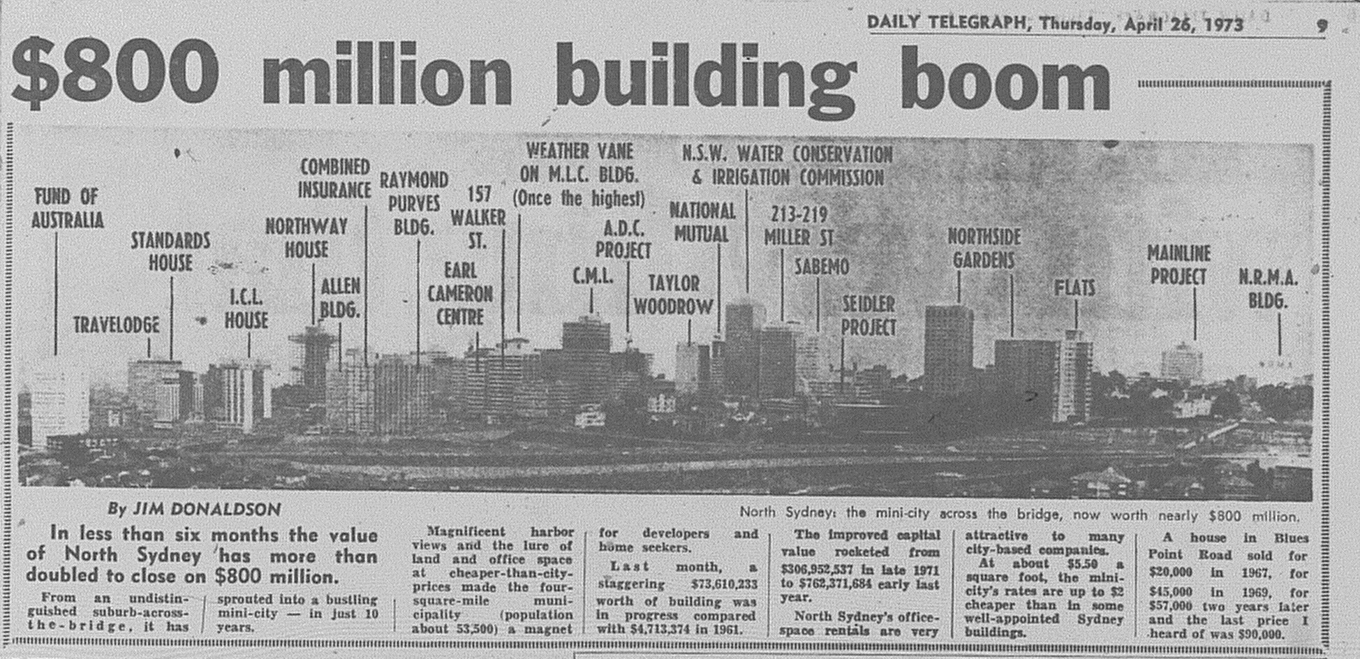
1973: North Sydney's booming skyline

Monday, 23 October 2023
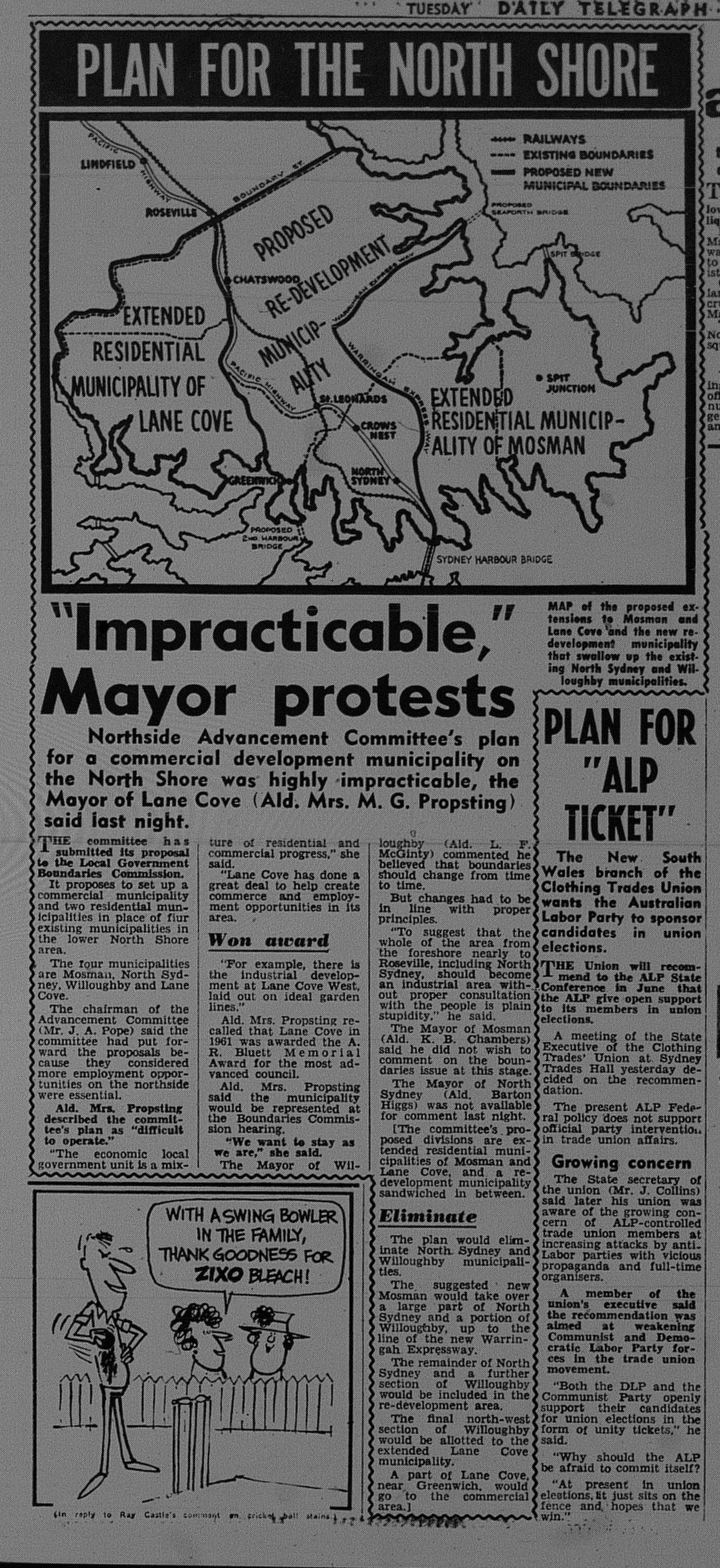
1964: North Shore Council Restructure

Above is a 1964 newspaper clipping from The Daily Telegraph with a map of new North Shore council boundaries proposed by the Northside Advancement Committee to the Local Government Boundaries Commission.
Under the proposed scheme:
- Lane Cove Council would be enlarged by around 25% to encompass parts of the Willoughby Council area west of the Pacific Highway. It became a predominantly residential area.
- Mosman Council would be enlarged by around 25% to encompass part of the North Sydney Local Government Area. Like Lane Cove, it would also be a predominantly residential area.
- Willoughby and North Sydney Councils would be merged to form a new local government area focusing on commercial development.

Monday, 16 January 2023
Remember This? The Changing City Photo Feature (1971)
Below are two photos that were published in a photo feature The Changing City, in The Daily Telegraph on 13 May 1971. The photos focus on the demolition of homes for the Eastern Suburbs Railway Line. The second photo also features highrise development taking place in the area, with the Kingsgate Hotel rising in the background. Note that Kings Cross, Darlinghurst and Woolloomooloo at the time were being subject to rezoning for highrise development, and proposals for highrise buildings had also been lodged, which were set to transform the area. However, with a few exceptions, the highrise developments did not proceed, and the area was allowed to retain its current densities and streetscapes.

Monday, 7 November 2022
1988: Early mention of a proposed North-West Rail Link.
I found an article from The Sunday Telegraph that was published in 1988 focusing on transport options for our North-Western Suburbs including Rouse Hill and Kellyville.
At the time, Rouse Hill and Kellyville were semi-rural suburbs with planning underway to develop them into new suburbs.

Monday, 24 August 2020
1960: An even earlier proposal for Transport Oriented Development at North Sydney
In 2016, I published an entry on an early scheme for Transport Oriented Development at North Sydney dated 1968.
Recently, I came across an even earlier proposal dating from 1960. The key differences between this and the 1968 scheme is:
- The Hotel was planned to be a hostel.
- The office building (13 Blue Street) was originally planned as a 22 storey apartment tower.
- The 9 storey office building (Zurich Building) appears to be longer.
Anticipated completion was 1962.
Source: Anon. 1960. "The Changing Face of North Sydney". The Sydney Morning Herald, September 20: 37.
Related Posting
1968: Early proposal for Transport Oriented Development at North Sydney
Monday, 7 May 2018
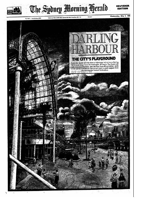
1988: Queen Elizabeth II opens Darling Harbour
 |
| Above: The Sydney Morning Herald produced a special supplement to mark the official opening of Darling Harbour on May 4, 1988. |
Since January, Harbourside opened in two stages and Exhibition Centre (demolished in 2014 for the new complex) was now ready for public use.
Source: Bilkey, M. 1988. "Frantic rush to get Darling Harbor ready". The Daily Telegraph, May 4: 13.
The Queen arrived on the Royal Yacht Britannia before being driven to Tumablong Park where she officially declared that Darling Harbour was open.
She also visited the First State 88 exhibition at the Exhibition Centre and did a public walkabout.
Below are newspaper clippings from The Daily Telegraph (May 5, 1988) and The Daily Mirror (May 4, 1988).
Monday, 29 January 2018
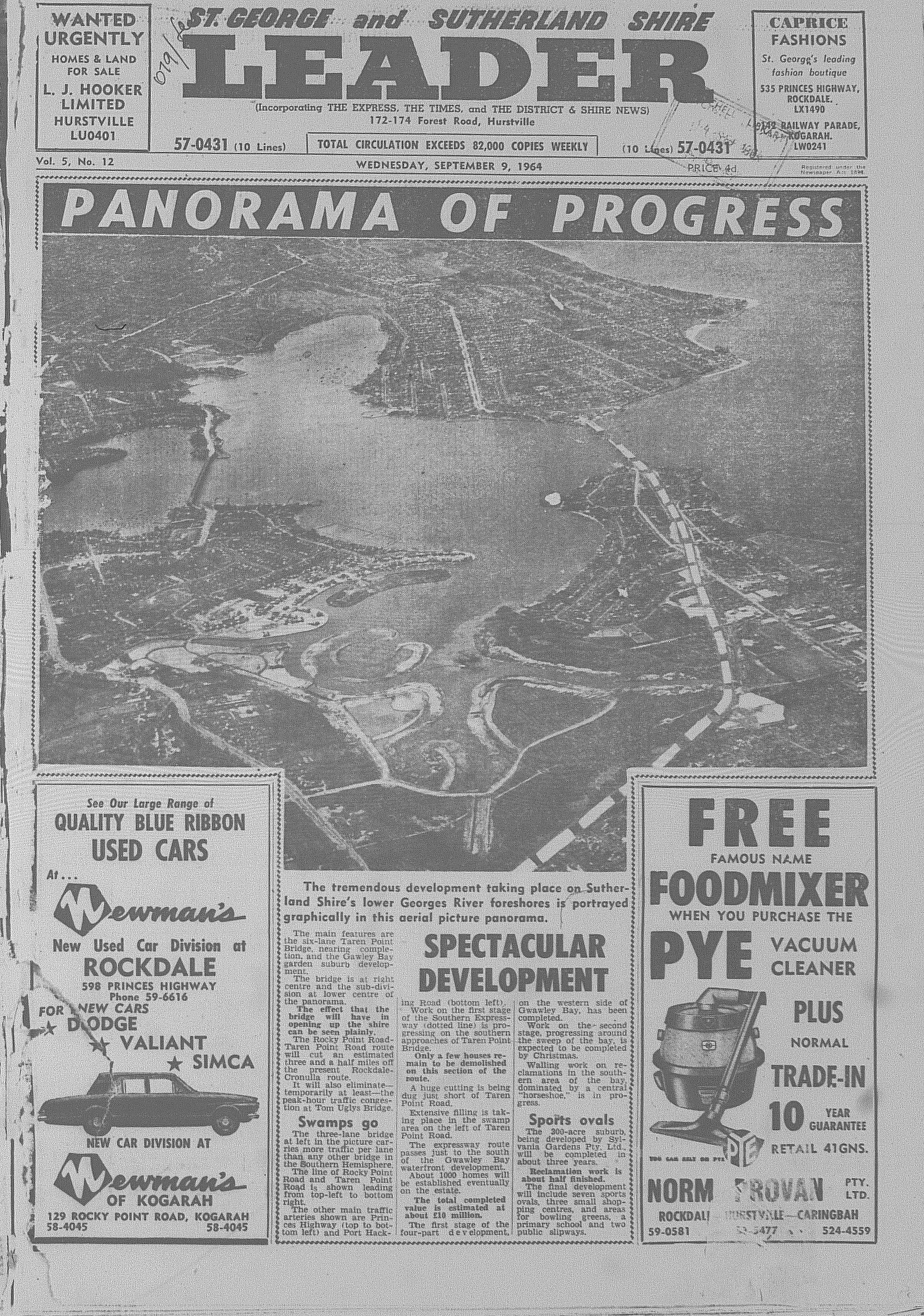
Remember This? Sylvania Waters taking shape (1964)
Monday, 5 September 2016
1974: The battle to save beachfront homes at Bilgola Beach
The East Coast Low of May 25-26 1974 (known as the Sygna Storm) is regarded as the most ferocious storm to ever strike Sydney. The city was pounded by heavy rain, strong winds (up to165km/h) and record swells of nine metres along the city's coastline. the worst damage was reported on the city's beaches, which were heavily eroded. The following fortnight saw another two East Coast Lows hit the city, which only worsened erosion.
The worst hit area was at Bilgola Beach, where homes in June 1974 were threatened with collapse which was quite similar to what happened at Collaroy this year. Below is the front page of the June 5, 1974, edition of The Manly Daily.
It is inevitable that the homes on the beachfront will be threatened again in the future as natural processes reshape the beachfront and retreat inland. There is no date for when it will happen, but luckily locals have not had to deal with the threat of losing their beachfront homes since that storm.
Monday, 25 July 2016
1998: Bruno Grollo & Sydney
At the time, he was in Sydney to attend the final concrete pour of their first project in Sydney - 1 Martin Place. It included the restoration of the famous GPO Building. Behind the stone facade, would rise a 25 level office and hotel complex. 1 Martin Place would open to the public less than a year later.
Source: Skelsey, M. 1998. "Grollo has high hopes for Sydney". The Daily Telegraph, December 11: 35
Grollo was keen to see if Sydney could end up with its own Grollo Tower, which believe it or not was at the same time he had won approval to build his 120 level, 560 metre tower in Melbourne which at the time would have been the world's tallest skyscraper.
The article mentions that Sydney's height limits (Capped at 235 metres) was due to the need to protect the views from Sydney Tower, which from what I am aware of, is not correct. From my understanding, Sydney's current height limits have stemmed from the need to allow sunlight to penetrate into city streets, public spaces and parklands.
This article from 1995 explains why:
Source: Skelsey, M. 1995. "The sky's not the limit: New city plans could reign in high-rise boom ". The Daily Telegraph Mirror, February 3: 14.
Earlier this month, Sydney City Council announced that it is proposing to increase the city's height limit from 235 metres to a maximum 310 metres., Already, there are proposals that are testing the waters for taller towers in central Sydney, with negotiations currently taking place between developers and the council. One proposal is for a 248 metre office tower at Circular Quay and a 260 metre apartment tower above the Event Cinemas complex in George Street.
Monday, 7 March 2016
1973: Sydney Harbour development
North Head, for instance, was envisioned as being a park with tree-lined roads but there would be a lookout tower and restaurant.
The vision that could have probably been the most controversial would have been the plan to build a massive marina at Balmoral. This would also include demolition of the famous baths. Balmoral is noted for its long beach, quiet waters and picturesque setting which attracts people from far and wide, so a marina may have not been the right move for the suburb. The idea for a large marina stemmed from the concerns about access to the harbour and mooring space.
It was proposed that other sites around the harbour would also house marinas, though many of those sites have not experienced marina development in any capacity.
Monday, 29 February 2016
1968: Early proposal for Transport Oriented Development at North Sydney
Source: Anonymous. 1968. "A Look At Tomorrow's North Sydney". The Sydney Morning Herald, April 8: 8.
In the end, the towers were built. The hotel (known today as the Harbourview Hotel) became reality as conceived.
 |
| Photo was taken by the Author. |
The two office towers were built, though they were to appear during the 1970's and1980's
The first office tower (middle) at 13 Blue Street was built in 1975 and is now known as the Fijitsu Centre. The tower rises 20 levels
 |
| Photo was taken by the Author. |
 |
| Photo was taken by the Author. |
However, they do not share the common podium as originally planned and there is a public square outside the Zurich Insurance Building for people to soak up the city and harbour views.
Monday, 10 November 2014
NEVER BUILT SYDNEY: Bondi of the Future Exhibition (1968)
Thank goodness Ben Buckler is still what it is. I prefer the older and smaller unit blocks.
Source: Anonymous. 1968. "Skyline 32 Years Ahead," The Daily Telegraph, November 19: 15.


