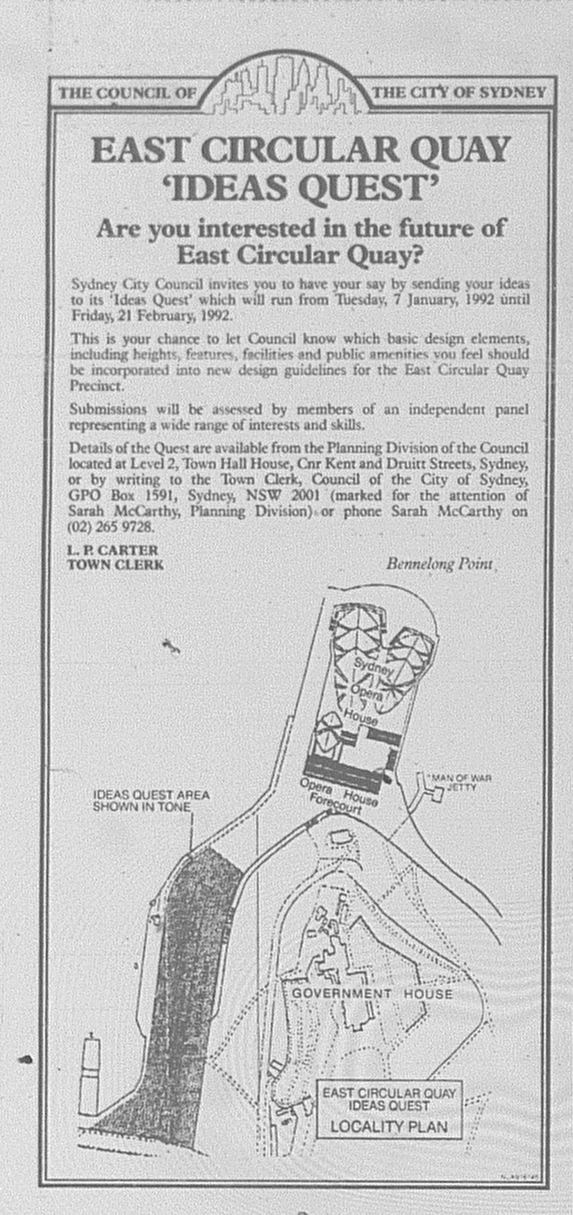
Source: Sydney City Council. 1992. "East Circular Quay 'Ideas Quest'" (Advertisement). The Daily Telegraph Mirror, January 6: 12.
This led to Sydney City Council reviewing the site's planning guidelines. In January 1992, it invited the public to submit ideas on how the site should be developed. Architect Ken Woolley assessed the submissions.
In March 1992, the submissions were placed on public exhibition.
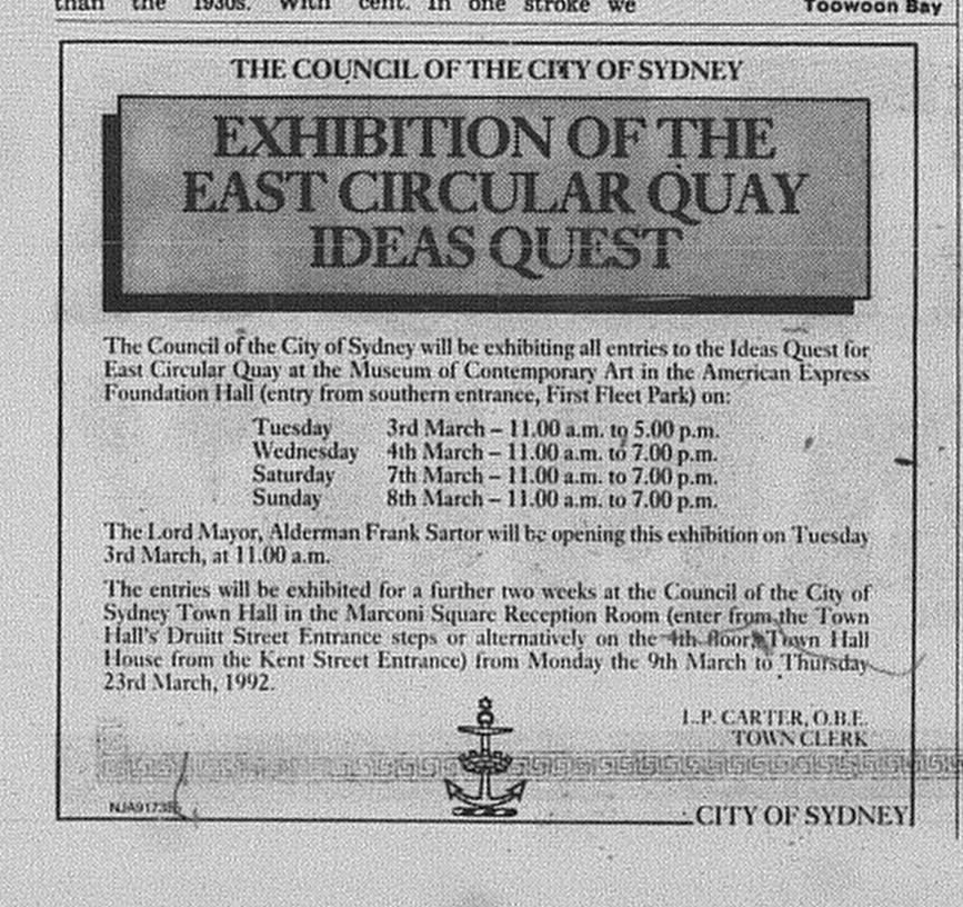
Source: Sydney City Council. 1992. "Exhibition of the East Circular Quay Ideas Quest". The Daily Telegraph Mirror, February 29: 23.
Below is a feature article from The Daily Telegraph Mirror featuring some of the submissions.
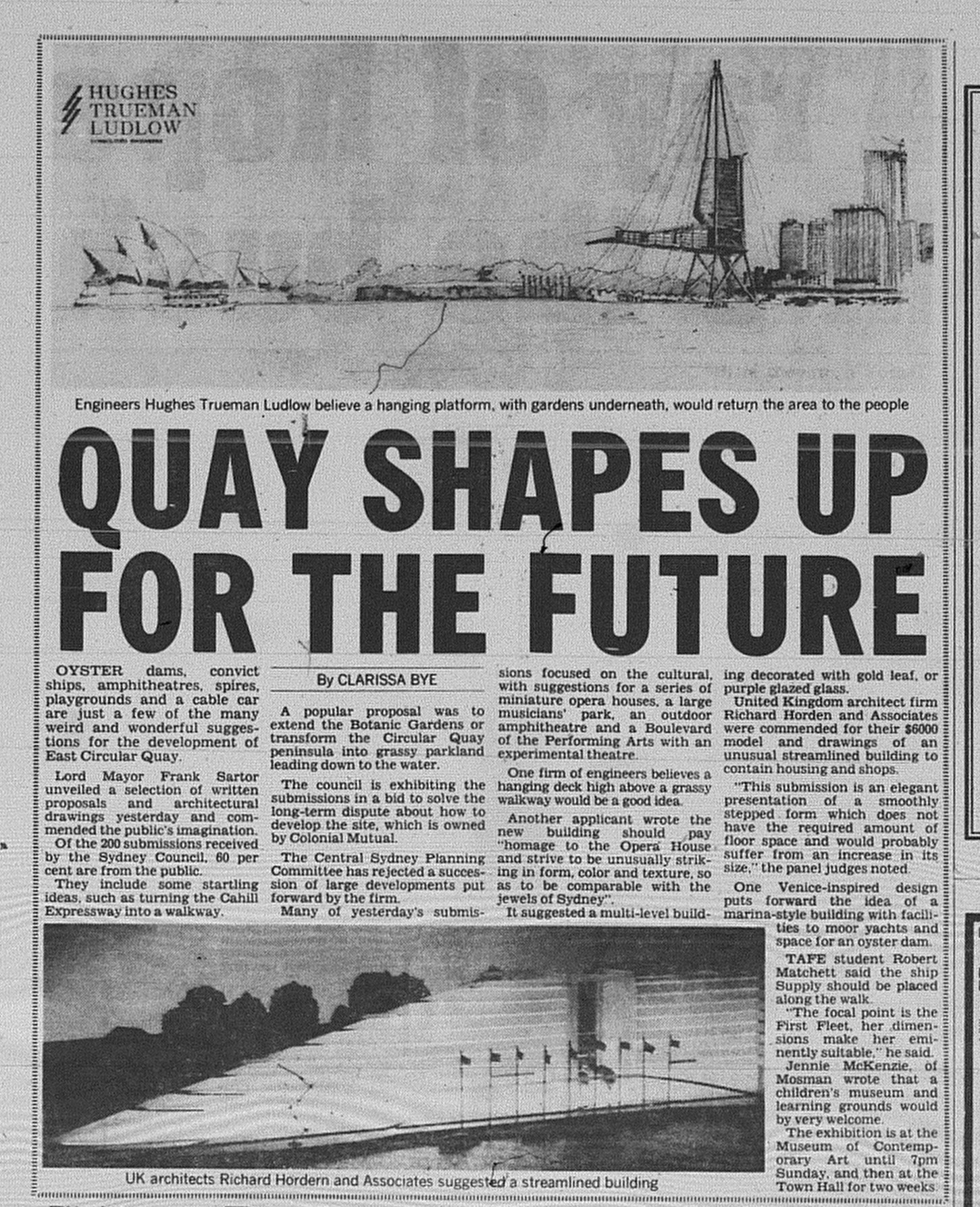
Source: Bye, C. 1992. "Quay shapes up for the future". The Daily Telegraph Mirror, March 4: page unknown.
Following the exhibition, new guidelines were drawn by the panel led by Ken Woolley. For the site owned by Colonial Mutual Limited (CML), a maximum height limit of 42.5 metres was set, which was lower than four of the buildings that either occupied the site or had been demolished. South of Moore Steps, future development would be capped at a maximum of 65 metres.

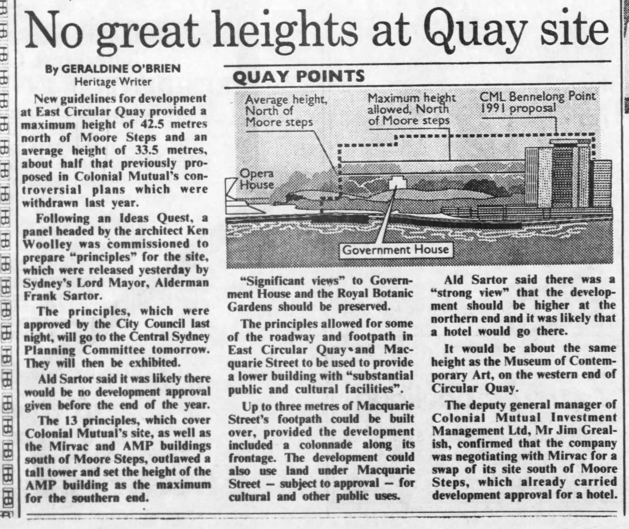
Source: O'Brien, G. 1992. "No great heights at Quay site". The Sydney Morning Herald, June 10: 4.
The guidelines also recommended:
- Provision of a cultural facility
- Utilise part of the existing roadway for pedestrian use
- Ground and lower floors to accommodate restaurants, retail, entertainment and tourist facilites.
- Possible use of land under Macquarie Street for public use.
The National Institute of Architects objected to the new guidelines.

Source: Anon. 1992. "Architects call for new Quay design". The Sydney Morning Herald, June 11: 8.
As I will be away during the school holiday period, I will have two Remember This? entries for the next two Mondays and will resume this series on May 6.
Entries in this series
- East Circular Quay Redevelopment (Series): The first apartment block proposal (1979)
- East Circular Quay Redevelopment (Series): Opera Garden Centre Scheme (1984)
- East Circular Quay Redevelopment (Series): Unilever House Hotel Conversion (1986)
- East Circular Quay Redevelopment (Series): Opera Garden Centre Scheme Revisited (1986)
- East Circular Quay Redevelopment (Series): Unilever House Hotel Conversion (1987)
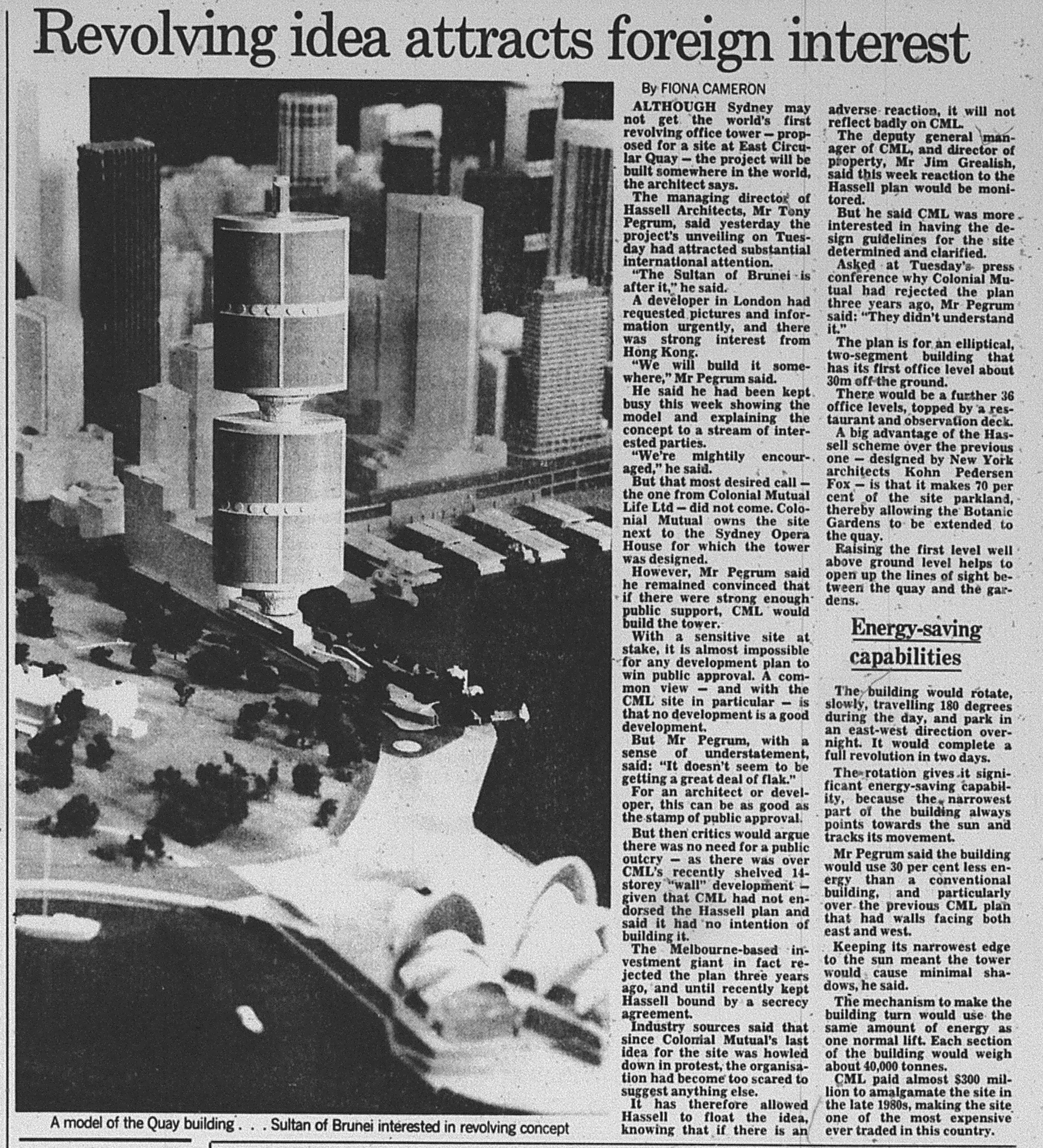
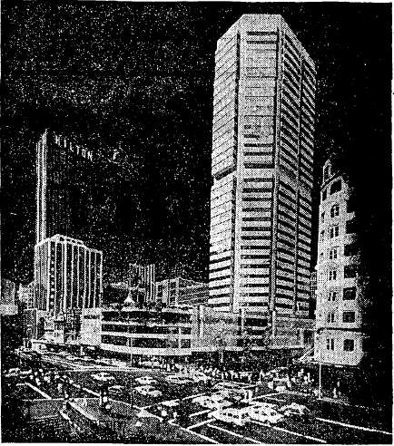
- East Circular Quay Redevelopment (Series): CML's 1990 Scheme
- East Circular Quay Redevelopment (Series): CML's Bennelong Centre (1991)
- East Circular Quay Redevelopment (Series): East Circular Quay Redevelopment (Series): The Revolving Office Tower Scheme (1991)